Date: January 31, 2015
Total time: 3 hour 27 minutes
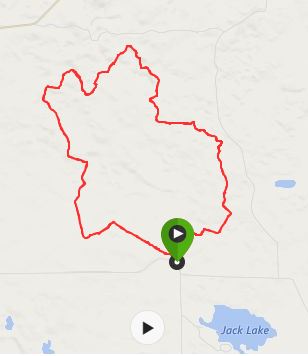
Distance: 20.3 Miles
My goal today was to hit some hills and ski about 20 miles.
Northern Wisconsin received a couple of inches of snow which freshened everything up. The trail was recently groomed so it wasn’t icy any more, but the skate deck still had a nice firm base.
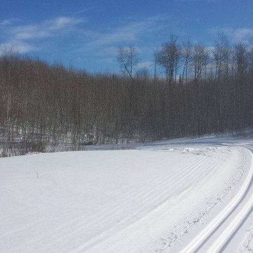
I started out on the outside loop of the Jack Lake Ski Trail and headed to the right. Moose Pass has lots of fun steep but short hills that were great to practice on. It also hits this crazy 4-way intersection where a trail passed through a valley between two steep hills — a good place to practice some control.
This 4-way intersection is at the bottom of two steep hills. This shot was taken while staring down Moose Pass towards Denali to the North.
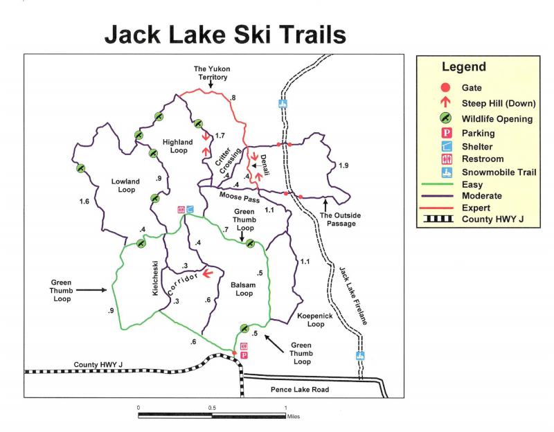
For an up-to-date map of the Jack Lake Ski Trail, visit the Antigo Chamber of Commerce website.
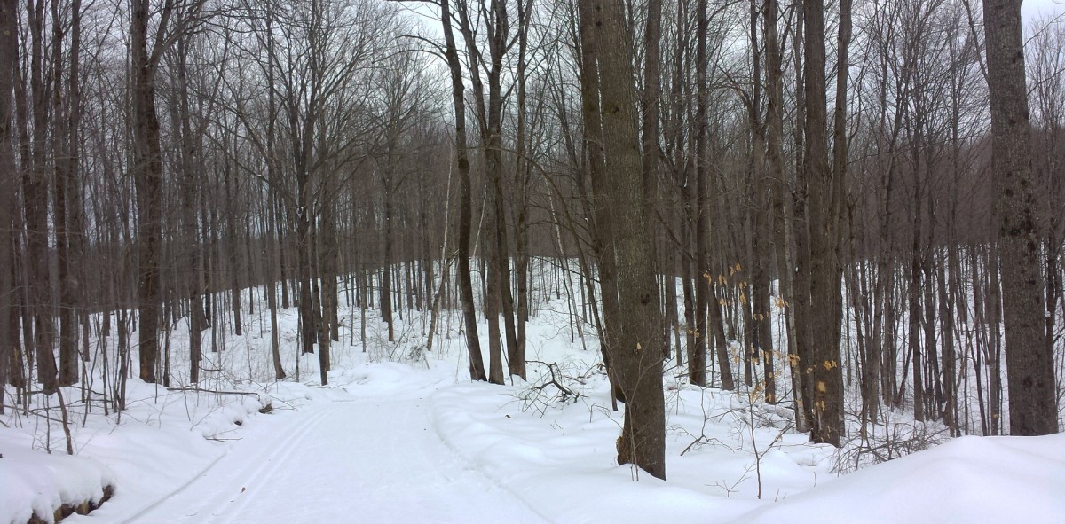
The Outside Passage had many dirty patches and one large exposed rock that I was able to avoid. It was a nice trail, but the dirt made me really nervous. I wouldn’t hit this stretch again until there is a lot more snow.
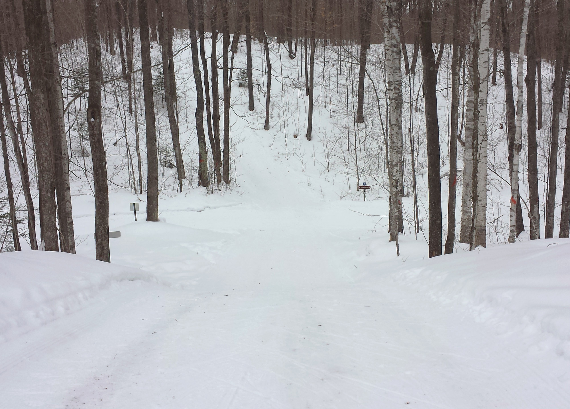
I decided to turn right on The Yukon Territory, which was still a little dirty. I felt pretty confident and the hills were fun. But then I hit the top of a really steep hill that had a lot of exposed dirt. “Eff this,” I thought and I put my butt on the ground before I slid down the hill. I scooted back up the hill and headed back the direction I came in.
Then I got really lost.

This was supposed to be a loop.
I decided to go back to the car, maybe ski somewhere else. I was super frustrated. I got back to the parking lot and a fellow ski lady said, “Great conditions today, aren’t they?”
And I was thinking, “Are we skiing on the same trail?” I was leaning towards giving up for the day and just making Sunday my long ski.
But then I realized, I had just gone about this all wrong.
I went to my car, gave myself a little time out, ate some food, drank some water and planned my next course.
Rather than heading straight towards the confusing section, I decided to take a left towards the Lowland Loop then hit the hills on the Highland Loop.
It was fantastic! There were some flat stretches, but plenty of fun and challenging hills. I got to hit the Moose Pass a couple more times. Then I just avoided The Yukon Territory and The Outside Passage — the rest of the trail was perfect.
On my second loop, my legs had started to fatigue a bit. I took some good, um, practice falls. All in all, it felt pretty good and was the longest distance I have ever skied.
That’s more like it.
Let’s talk about nutrition.
This was the first time I’ve ever skied using the fanny pack. There’s probably a better name for this thing, but basically it is a belt that holds a single water bottle that you see many experienced skiers wearing out on the trails. The bottle of water added some extra weight, but was completely out of the way. I was pleased to find that the extra weight didn’t seem to bother my back at all.
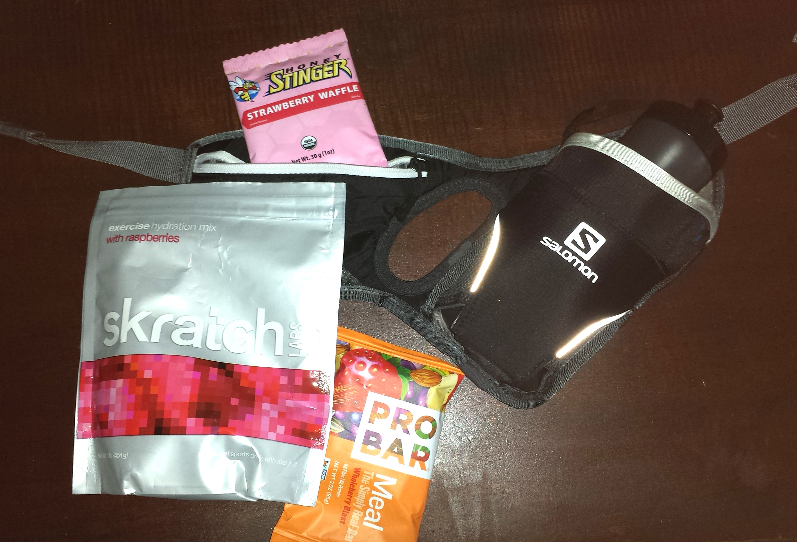
I added some Skratch to the water, which provided some needed calories and salt. I also ate a couple of Honey Stingers on the course, then ate a protein-heavy Probar afterwards.
I am not a sports nutritionist, but this is this is the stuff that works for me.
I have found that I can digest a bit more while skiing compared to what I can digest when running (mostly GU energy gels). I treat nutrition while skiing a little closer to how I treat nutrition on the bike. If my ski is going to be more than an hour long, I try to get some calories in around each 45-minute mark.
I try to hydrate ahead of time and in a pinch, will totally eat some snow on the trail.
It makes me feel five years old. I love it.
Notes on Jack Lake:
- Most trails allow for two way skiing. Though this opens up more possibilities, it means you should be careful ascending or descending hills.
- If you go to Jack Lake for an extended period of time, bring your own toilet paper.
- Maps are available at most intersections — the trail’s really not that complicated. I pretty much lost track of which direction I was coming from, which didn’t help.
Andrea Roenning – January 31, 2015 – Category: Wisconsin Skis